


Since last summer, this little half-marathon had been on my mind, previously only dreamed up on a map. Thanks to Nana, I finally made it happen. I trimmed a few kilometers, as I was already familiar with those sections, but it was still perfect for a Saturday morning – fitting into Leno’s nap time – and just right for being five months pregnant.
Trains to Semmering run every two hours, so I had time in the morning to take care of things at home and play a bit. I left the house at 9:57 AM, warming up with about 700 meters of jogging to the first track.
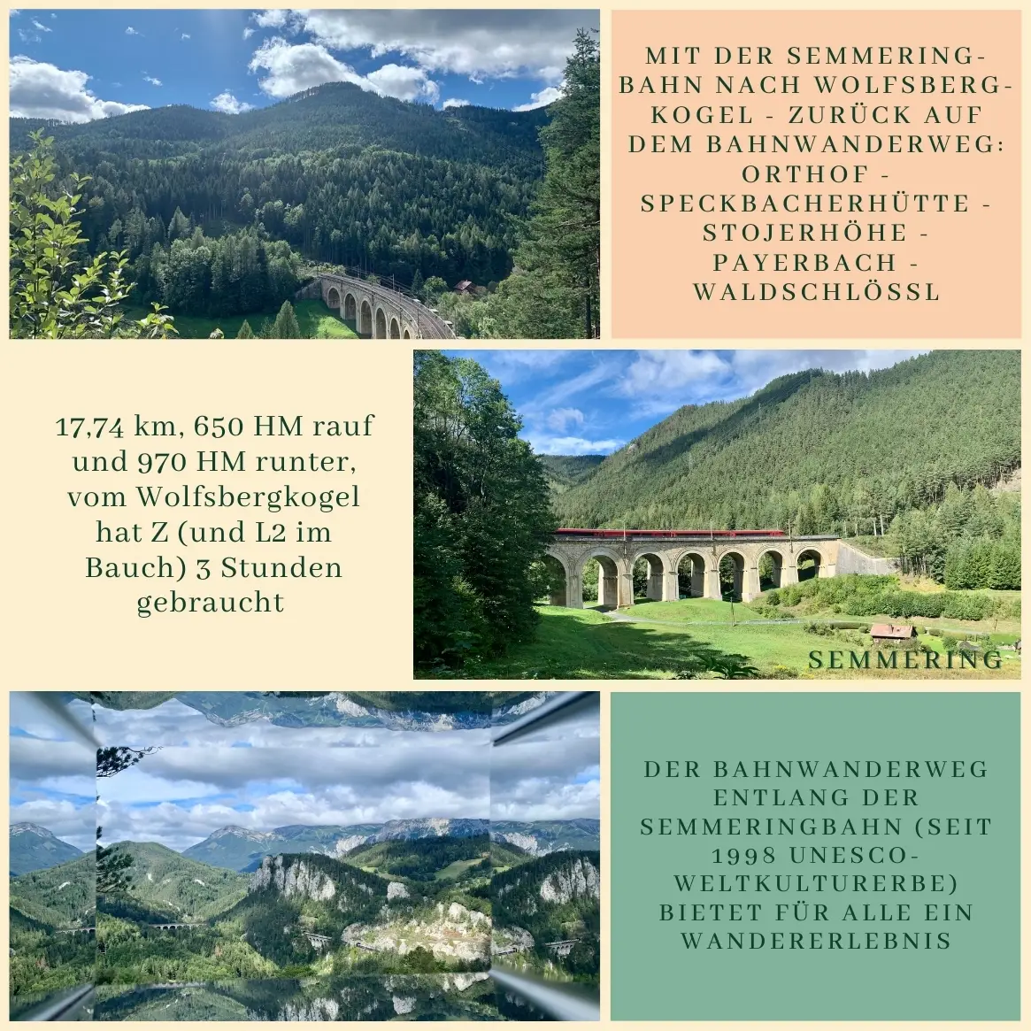
I already knew the Semmering–Wolfsbergkogel section, so this time I started from Wolfsbergkogel station. For the same reason, I skipped the Doppelreiter lookout, but I wholeheartedly recommend both to anyone visiting for the first time.
⸻
The Bahnwanderweg, or “railway hiking trail,” follows the famous Semmering Railway, a UNESCO World Heritage Site since 1998. Along the way, there are breathtaking views of the Semmering-Rax-Schneeberg region and the famous viaducts.
Starting from Wolfsbergkogel station, I passed the old Kurhaus Semmering – built in 1909, still exuding a special atmosphere – and headed towards the 20-Schilling viewpoint. From there, all the surrounding mountains and peaks are clearly visible: from left to right, the Rax (Heukuppe, Predigtstuhl, Jakobskogel), the Kreuzberg, the Schneeberg (Klosterwappen), the Krummbachstein, and the Gahns.
Although there’s a shorter route to Breitenstein, I chose the longer and more scenic path this time. After about 2.8 km, there’s a small refreshment point (Labestation), and along the way, you pass the Ghega Museum, showcasing the work of Carl von Ghega, the visionary behind the Semmering Railway. After the museum, I turned left and approached the Speckbacherhütte via Orthof.
Here comes the only noticeable ascent of the tour: about 400 meters uphill, but in return, you’re greeted with beautiful forest trails and tranquility.
At the Speckbacherhütte, I enjoyed a well-deserved coffee – the sun filtering through the tree canopies, it was quiet and peaceful. From there, it was just a jog down: through the Stojerhöhe to Payerbach, where I got caught in a brief rain shower. One last climb under the railway overpass, up the hill, and I was home just in time: Leno had just woken up.
Route: Wolfsbergkogel – 20-Schilling Viewpoint – Orthof – Speckbacherhütte – Stojerhöhe – Payerbach – Waldschlössl
Distance: 17.74 km
Elevation Gain: +650 m / –970 m
Time: Net 3 hours, pace: “pregnant” slow trail running