I always get a kick out of overhearing Hungarian hikers on the Rax. They tend to assume they’re the only ones around who understand their conversations:
“Of course, my kids sleep in the car, but these Austrians seem to do things differently…”
But let’s start from the beginning. I’ve owed you this trip report for about two months now, but with another round of Rax-loving guests arriving tomorrow, I finally found the motivation to write it up.
When Zsófi visited us in June, we knew we had to take her on a proper Rax adventure – you know, something for the memory bank. 😉
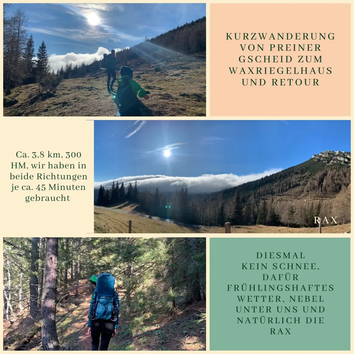
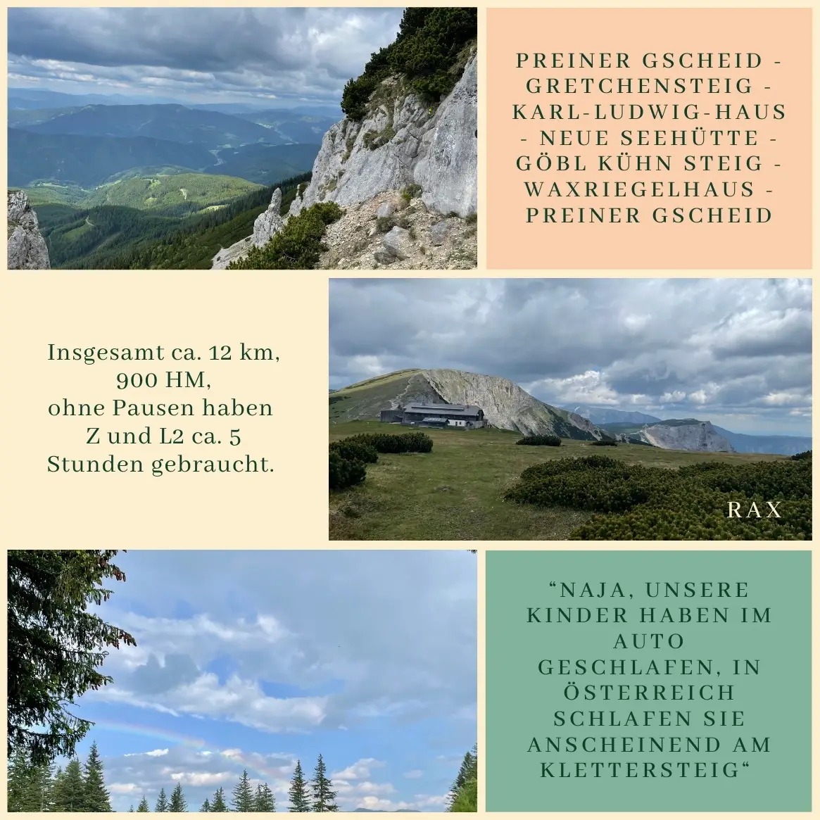
We set off on a sunny June morning (Zsófi and L) and a bit later in the day (Zita and L2), heading down to the train station in Payerbach. From there, we took a bus to the Preiner Gscheid, where our hike started about 30 minutes later. (And by the way, if you can decipher the bus timetable, you deserve a 10% discount on your next booking – here’s the challenge: Timetable.)
The lower sections of the Reisstalersteig and the Gretchensteig share the same path almost all the way to the Reisstalerhütte. Just before you reach the hut, a steep trail branches off to the right, offering fantastic views – at least until you’re swallowed up by the forest again. This is where Zsófi and L took a quick break, and I, driven by the motto “anything for a peaceful nap”, pushed on with L2.
This stretch eventually leads up to the Gretchensteig itself. Just before the actual via ferrata, there’s a rocky section, which, if you ask me, is trickier than the secured climbing passage that follows – but I’ll let everyone judge that for themselves.
“Wait, is that a kid up there?!”
“Hey, that’s a woman! Where’s her husband? Probably at home mowing the lawn.”
“No way she’s making it up there. We barely managed to come down. There’s got to be another way.”
“Of course, my kids sleep in the car, but these Austrians seem to do things differently…”
As the Hungarian group (decked out in full via ferrata gear) slowly picked their way down what they clearly considered “challenging” terrain, I had plenty of time to translate their colorful commentary for the Austrian hiker beside me – who, by the way, described the section as “no big deal”. Safe to say, we both got a good laugh out of it. 😉
And honestly, this whole encounter is a perfect example of how the same mountain trail can feel like a completely different challenge depending on who you are and how you approach it.
Once we reached the top, we skipped the usual break at the Karl-Ludwig-Haus and continued straight to the Neue Seehütte. About 30 minutes before reaching the hut, we had to pause for a quick hillside picnic (L2’s idea), before tackling a steeper descent that ended with a fantastic, gluten-free, vegan lentil stew.
The mountain had one last surprise for us – a sudden hailstorm (oh, June, you never fail to keep us on our toes) – before we met back up with Zsófi and L at the Waxriegelhaus. Together, we made it just in time for the last bus down.
Final stats: Roughly 12 km, around 900 meters of elevation gain and loss, and about 5 hours of hiking time with L2, plus three snack breaks. And as a little parting gift, we even caught a rainbow on our way back – a nice way to make up for the earlier hailstorm. 🌈
Preiner Gscheid – Gretchensteig – Karl-Ludwig-Haus – Neue Seehütte – Göbl Kühn Steig – Waxriegelhaus – Preiner Gscheid