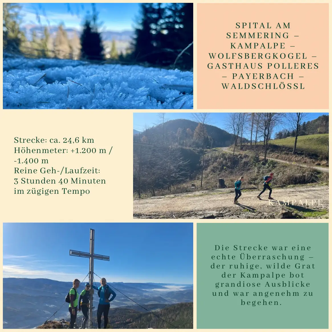
While the boys were off on their own adventure, the four of us women enjoyed a “girls’ day” – discovering a brand-new route, even for me. We took the train to Spital am Semmering, then set off on foot and at a light jog along the Kampalpe ridge, following a long, varied trail all the way back to Payerbach and finally home to the Waldschlössl.
Net time: 3 hours 40 minutes of steady hiking and jogging
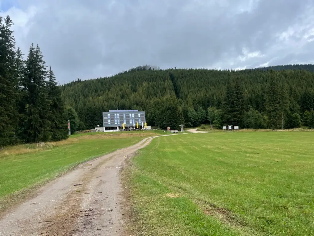
A true autumn gift – sunny skies, frosty paths, cool valleys, and crisp air. The trail was a real surprise – the peaceful and untamed Kampalpe ridge offered stunning views and a very runnable, scenic route. After Wolfsbergkogel, just as our energy began to dip, we reached Gasthaus Polleres at the perfect time. We stopped for a quick refreshment and were warmly welcomed – such hospitality is rare these days.
A truly special day – not just for the views or the route, but because of the great company, the calm of the mountains, and the magical autumn light. Days like these are a beautiful reminder of how many ways there are to recharge: through movement, meaningful conversation, and good companionship.
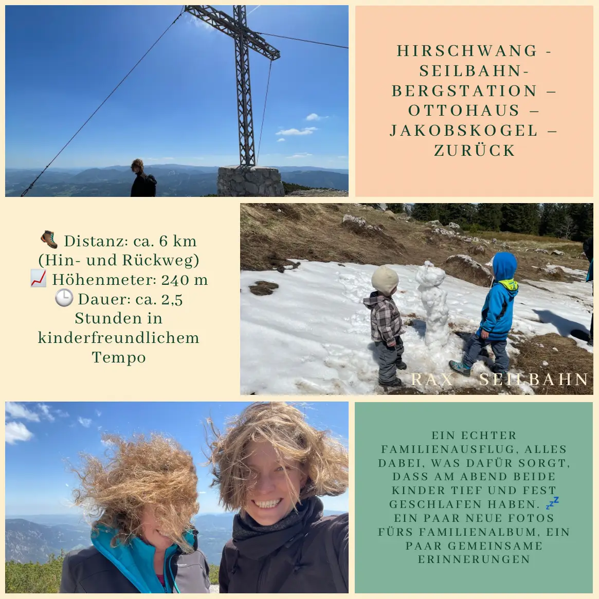
We’ve been living at the Waldschlössl for over three years now, and even though we’ve explored the Rax countless times, we’ve somehow always skipped the Jakobskogel. It’s one of those classic peaks on the Rax that’s popular with tourists – reachable even for us mere mortals who don’t want to hike 10–20 km or conquer 700–800 meters of elevation. We added our own twist: 🚲 cycling, 🚡 a cable car ride, windy 📸 photo ops, and a real summit push. 🏞️
The lower station of the Rax cable car is located in Hirschwang, about 6.5 km from our home. With our electric bikes and a bike trailer (Z + L1 + L2), we made it there in about 25 minutes. Those who prefer not to pedal can choose to go by 🚗 car, 🚌 scheduled bus, or use the flexible Rufbus service.
The cable car quickly took us up the mountain (1,546 m), and from there we headed toward the Jakobskogel. The summit is at 1,736 meters, and is supposed to be about an hour’s walk from the station – it took us closer to 1.5 hours, but we had to inspect every second bush. 🌿👀
The Ottohaus was the perfect spot for a snack break 🧃🥪. While L1 enjoyed a well-earned snack with Nana, the rest of us (Aunt Gi, Z and L2) made the most of the windy but sunny weather to take some fresh family 📷 photos at the top.
The hike there and back is around 6 km, with 240 meters of elevation gain. At a relaxed, family-friendly pace, it took us about 2.5 hours. If you still have a bit of energy left on the way down, it’s well worth taking a short detour to the Höllentalaussicht for a breathtaking view of the entire valley. 🌄✨
⸻
🗺️ Route: Hirschwang – Rax Cable Car – upper station – Ottohaus – Jakobskogel – return
🥾 Distance: approx. 6 km round trip
📈 Elevation gain: 240 m
🕒 Time: approx. 2.5 hours at a kid-friendly pace
⸻
🎒 It turned into a perfect family outing: aunt, grandma, friends, kids, cable car, mountaintop – everything you’d want in a day that ends with both kids sleeping soundly. 💤 A few more photos for the family album, some shared memories – and another summit conquered. 💚🏞️
One day, all that will remain are the shared experiences. The moments we lived together. Songs, scents, sounds. The memories.
May 27, 2008
My father was 54 years old when, while mowing the lawn, a sudden heart attack took him from us within seconds. One wrong move, an unexpected illness. And suddenly, everything changes.
July 20, 2024 – Saturday
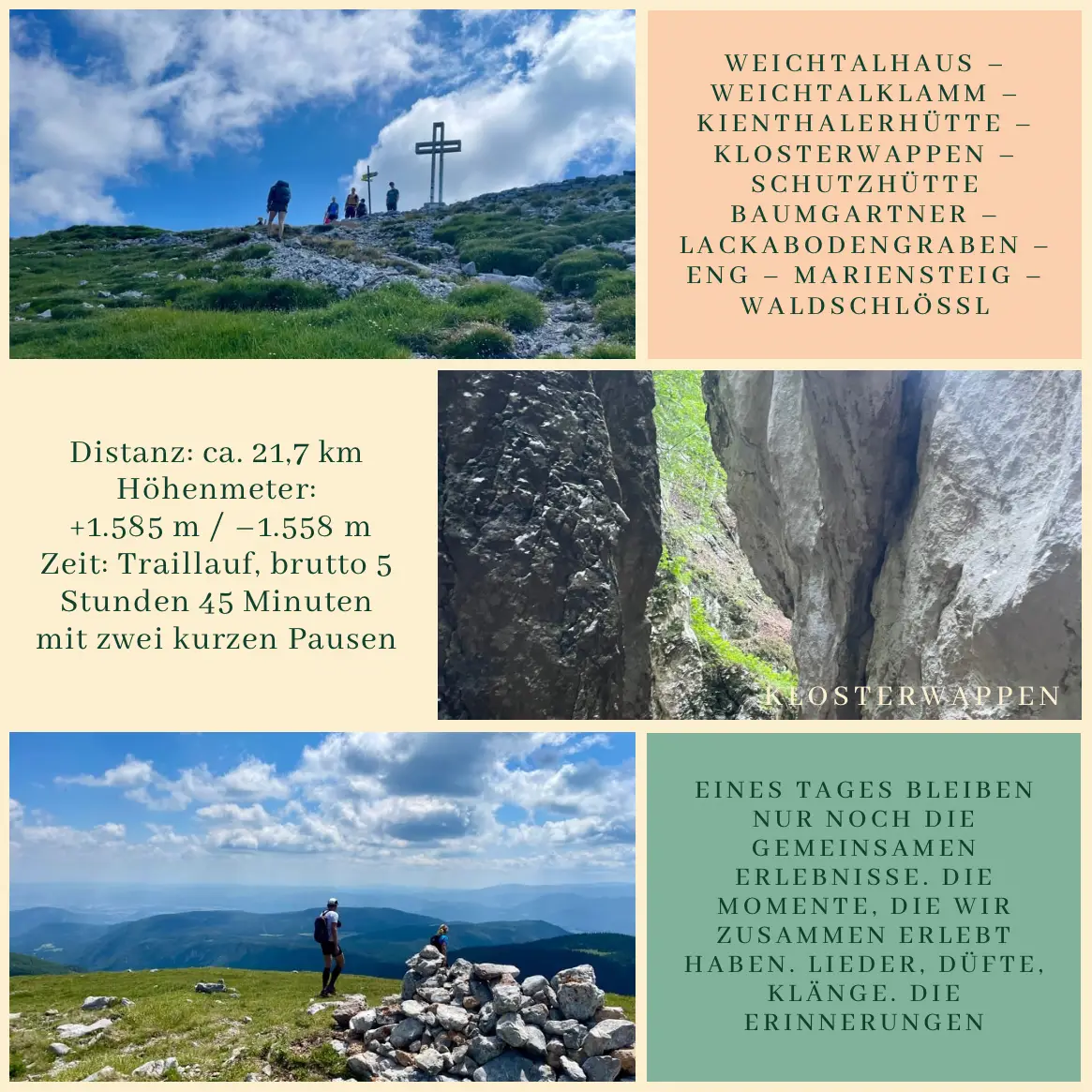
Anne, a dear running friend from Vienna, wrote: “Tomorrow: Weichtalklamm, Schneeberg, Buchtelhütte and back – with Pascal.” A quick check-in with Christian – the boys were heading to St. Corona for a “guys’ day” – and I got the green light.
This tour had been on my bucket list for a long time. But I kept postponing it. On the one hand, I wasn’t sure whether it was a good idea to hike through the Weichtalklamm on my own (even though Christian put it this way: “Of course I know it – I used to RUN down that route.” 🤪) On the other hand, such a tour requires at least half a day off. Today, everything aligned perfectly.
July 21, 2024 – Sunday
By 8:30 a.m. I was already at the bus stop in Payerbach. I was one of the last to board – the bus was full after that. Of course, Anne and Pascal were among the first. Shortly after nine, we arrived at the Weichtalhaus in the Höllental.
The gorge was breathtaking. The steep trail, the rocks, the ladders, the climbing – every step felt like it was pulling us upward with some invisible strength. It’s rare to go on a trail run or mountain hike with three people where everything just flows: no explanations, no waiting – like a well-practiced team. I have never met a more cautious and thoughtful man in the mountains than Pascal. He knew and respected the area like very few others.
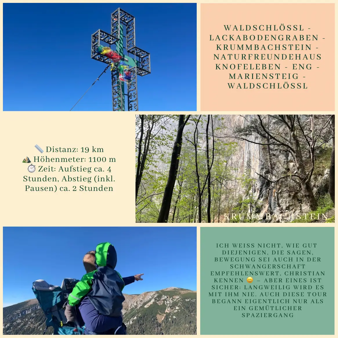
By 10:30 a.m. we reached the Kienthalerhütte, and shortly before noon we stood together at the summit of the Klosterwappen – 2,076 meters – the highest point of the Schneeberg. From there we continued quickly to the Baumgartner hut – Anne and Pascal were rewarded with a well-earned Buchtel, and I got a large elderflower juice. Just a few minutes later, we jogged on – through the Lackabodengraben, across the Eng, along the Mariensteig, and finally down to the Waldschlössl.
There are tours that are about more than just running. They are moments that etch themselves deep into memory. This day was one of them.
Duration: trail running, 5 hours 45 minutes total, including two short breaks
—
End of August 2024
About a month later, the news arrived:
“Hohe Wand. 54-year-old man fatally injured while climbing.”
July 21, 2024
On the trail between the Kienthalerhütte and the Klosterwappen, there is a cross. We arrived there at exactly 11:00 a.m. We paused for a moment, taking in the view. Pascal could name every peak around us. He knew the mountains. A strange feeling came over me as we read the inscription on the cross:
“Stop and read:
What you are now, I once was.
What I am now, you shall one day be,
And you too will be covered by the same earth…”
No grand words were needed. Only the steps. The rocks. The July sunshine. The silence. The moments that remain. And the gratitude for the time shared.
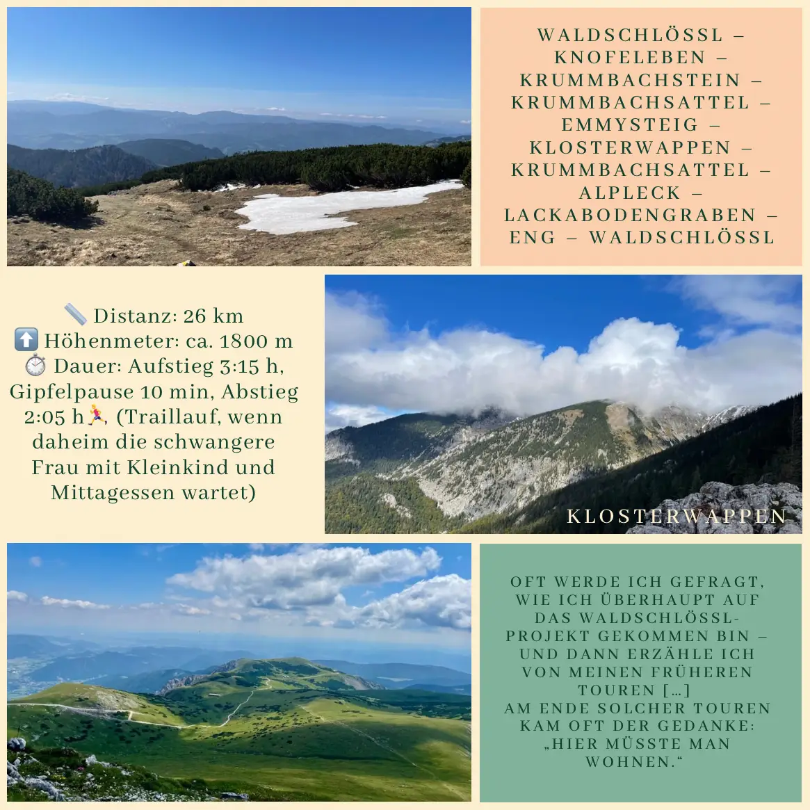
It’s been over three years since we started the Waldschlössl project, and ever since then, I (Christian) hadn’t been back up the Schneeberg – even though, when viewed from the Schwarzatal, the Waldschlössl quite literally sits on its slope. During those first years, before we had moved into the Waldschlössl, I hardly went hiking at all – I only came here to work on the construction site.
Only after we moved to Schneedörfl did mountain hikes slowly return to our lives – but they usually led to the Rax or, at most, to the Krummbachstein on “our side” of the valley.
And yet, the thought never really left me. People often ask how I came up with the idea for the Waldschlössl project – and then I tell them about my earlier hikes: from Puchberg up the Schneeberg, then down via the Eng, past what is now our home, and finally to the train station in Payerbach-Reichenau. At the end of those hikes, I often found myself thinking, “You should live here someday.” Over time, a mix of wistfulness and ambition grew out of those memories – and that’s what ultimately motivated me to take on the Schneeberg again, after all these years.
Zita kindly offered to take care of the kids that Sunday – so I set off early in the morning at 6:05. The mist in the valley had just started to lift, everything was still damp from the night, but otherwise, the weather was perfect for a mountain tour.
I made good progress: by 7:09 I was already at Knofeleben, then headed straight on to the Krummbachstein (on the summit by 7:43), took a short break, and jogged down to the Krummbachsattel. From there, I climbed the Emmysteig trail up to what I call the “half-shoe hiker highway” – the wide path that runs from the upper station of the Schneeberg cog railway to the Fischerhütte.
That’s where I met the first other hikers of the day. Still, it’s a stretch you can jog again for a bit, before reaching the final steep climb to the Klosterwappen.
At 9:21, I stood on the summit – the highest point of the Schneeberg. I ate my sandwich, enjoyed the quiet (and the fact that there were still only a few people around), and after a 10-minute rest, I started heading back down.
I returned to the Krummbachsattel via the same path, but skipped the Krummbachstein this time. Instead, I ran down via Alpleck, through the Lackabodengraben, and along the Eng – practically in one go – back home.
At exactly 11:29, I arrived at the Waldschlössl – just in time for a warm lunch. Thanks, Zita 😉
⏱️ Duration: Ascent 3:15 h, summit break 10 min, descent 2:05 h 🏃♂️ (trail running – when your pregnant wife and toddler are waiting at home with a hot lunch)
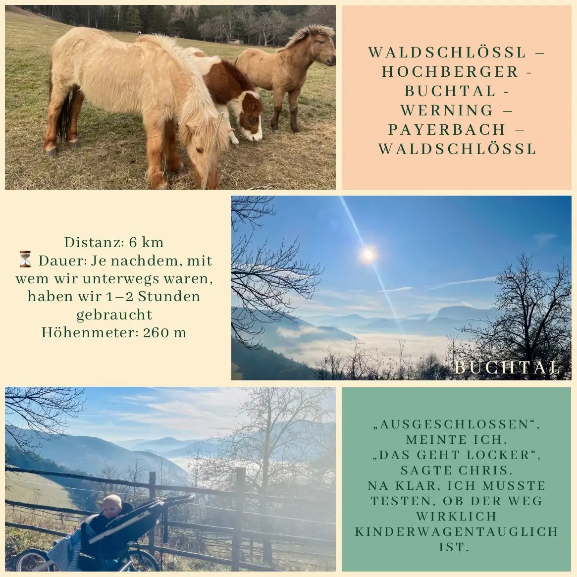
What’s great about hikes around the Waldschlössl is that even familiar destinations can take on a whole new character when approached from a different direction. This time, our goal was once again the NaturfreundehausKnofeleben – but we “attacked” it from a different side.
I’m not sure how well the people who recommend staying active during pregnancy know Christian 😄 – but one thing’s for sure: it’s never boring with him. This hike started out as a gentle walk (we weren’t going all the way up the Rax summit 🏔️).
We set off from Waldschlössl, as usual, and headed toward the Lackabodengraben. The path climbs gradually and pleasantly. Once at the top, instead of turning left toward Knofeleben, we continued straight on the red-yellow-red trail up to the Krummbachstein summit. Although this route is longer (around 4 km instead of the steeper 2 km), it’s much gentler – and we even saw a little snow ❄️ up there.
The sunshine ☀️ stayed with us all day, and – a rare exception – there was no strong wind at the summit. We had the chance to fully enjoy the colors and calm of autumn 🍂🍃.
That day marked the start of my seventh month of pregnancy🤰, and, as it turned out, it was my last long hike with L2 in my belly. (After that, we only made it as far as Knofeleben.)
We descended via the steeper trail heading toward Knofeleben. Honestly, I wouldn’t recommend this route while pregnant 😅 – but with a break at the house (🍲🍲🍲 and a kid’s paradise: toy chainsaw, train 🚂, tiny cars 🚗, little playground), it turned out quite nice.
From there, we followed the tractor path down toward Eng – an easy and gentle track that even made Leno want to run 🏃. And he did! He ran the first 4 km with us – and even waited for me sometimes, which I deeply appreciated ❤️.
On what was just another working Saturday – at least according to Christian, who was busy building the greenhouse – Z and the two Ls set off to make the most of the sunshine, our Lower Austria Card, and most of all, the great company of our friends from Vienna
This day was all about tapering – with a trail running race ahead for L1 and me the next day, this hike was more of a gentle warm-up and a laid-back day (Spoiler: It wasn’t).
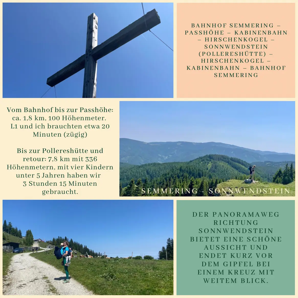
Our logistics worked like a charm: we rolled down to the train station by bike, had our snack on the train, L2 took a short but efficient nap, and soon we arrived in Semmering. From there, we headed towards the cable car and met up with our friends from Vienna: kids company ✅, hiking motivation ✅.
A few minutes later, the gondola took us up to Hirschenkogel – a familiar place for the kids from last year, with its awesome playground, water fun, marble run, climbing frames, and pre-lunch picnic. From there, we continued on the panorama trail towards Sonnwendstein. It’s a bit longer and steeper than the forest route, but the views are stunning – and from the big cross near the summit, you get almost the same breathtaking vista as from the actual peak. Since I had sworn just three weeks earlier not to climb that mountain again for a while (More), this was a great alternative. Everyone agreed: one summit a day is plenty 😅.
All four kids hiked with enthusiasm. We carried the little ones now and then, while the two older boys managed to walk most of it on their own. When L1 got tired of the uphill, we did what Boribon (a Hungarian bear from a children’s book) would do after falling and bumping his knee: he carried the backpack, I carried him. Or in his words:
“Mum, I’m in the front, because L2 is in the back!”
At Pollereshütte, they had tasty local dishes, plus a gluten-free and vegan lentil stew – highly recommended. After a short rest, we headed back down via the forest trail.
Finally, we took the gondola down again – and thanks to our friends, we even got a ride back to the Semmering train station. From there, it was a smooth trip home.
⸻
Route: Semmering Train Station – Passhöhe – Cable Car – Hirschenkogel – Sonnwendstein (Pollereshütte) – Hirschenkogel – Cable Car – Semmering Train Station
Hiking Distance:
• From the train station to the cable carbase: about 1.8 km, 100 meters elevation gain. L1 and I did it in 20 minutes at a brisk pace.
• Hirschenkogel–Pollereshütte–Hirschenkogel: 7.8 km with 336 meters elevation gain. With four kids under five, it took us 3 hours and 15 minutes.
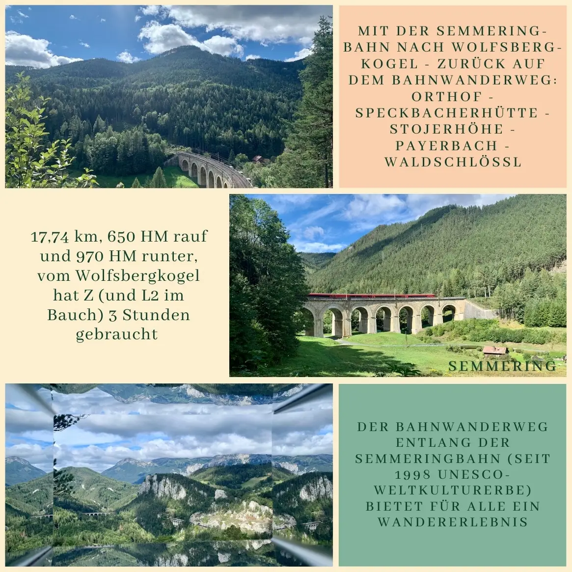
Since last summer, this little half-marathon had been on my mind, previously only dreamed up on a map. Thanks to Nana, I finally made it happen. I trimmed a few kilometers, as I was already familiar with those sections, but it was still perfect for a Saturday morning – fitting into Leno’s nap time – and just right for being five months pregnant.
Trains to Semmering run every two hours, so I had time in the morning to take care of things at home and play a bit. I left the house at 9:57 AM, warming up with about 700 meters of jogging to the first track.
I already knew the Semmering–Wolfsbergkogel section, so this time I started from Wolfsbergkogel station. For the same reason, I skipped the Doppelreiter lookout, but I wholeheartedly recommend both to anyone visiting for the first time.
⸻
The Bahnwanderweg, or “railway hiking trail,” follows the famous Semmering Railway, a UNESCO World Heritage Site since 1998. Along the way, there are breathtaking views of the Semmering-Rax-Schneeberg region and the famous viaducts.
Starting from Wolfsbergkogel station, I passed the old Kurhaus Semmering – built in 1909, still exuding a special atmosphere – and headed towards the 20-Schilling viewpoint. From there, all the surrounding mountains and peaks are clearly visible: from left to right, the Rax (Heukuppe, Predigtstuhl, Jakobskogel), the Kreuzberg, the Schneeberg (Klosterwappen), the Krummbachstein, and the Gahns.
Although there’s a shorter route to Breitenstein, I chose the longer and more scenic path this time. After about 2.8 km, there’s a small refreshment point (Labestation), and along the way, you pass the Ghega Museum, showcasing the work of Carl von Ghega, the visionary behind the Semmering Railway. After the museum, I turned left and approached the Speckbacherhütte via Orthof.
Here comes the only noticeable ascent of the tour: about 400 meters uphill, but in return, you’re greeted with beautiful forest trails and tranquility.
At the Speckbacherhütte, I enjoyed a well-deserved coffee – the sun filtering through the tree canopies, it was quiet and peaceful. From there, it was just a jog down: through the Stojerhöhe to Payerbach, where I got caught in a brief rain shower. One last climb under the railway overpass, up the hill, and I was home just in time: Leno had just woken up.
Saturday. According to Chris, it’s the best workday of the week – finally “no one from the office bothers him.” Since we have two kids, it’s been harder to set off on hikes alone with them: at least one needs to be carried, plus a backpack, a bit of logistics… and still, these are the outings that turn into our fondest memories. Especially when someone joins us.
All you need to know about our immediate neighbors is that L2 counted both of their names (or something close 😅) among his first ten words. My main contribution to the hike was knowing the route and having a plan – and ensuring good company (since both boys came along). Karin (“Tári”) and Grandpa Christian (“Sztán”) brought everything else we could need: a flashlight, snacks, fruit, good spirits – basically everything a child could wish for.
Our destination was the Speckbacherhütte, where Alexandra welcomed us once again with a fantastic lunch – including vegan and gluten-free options.
We started our hike in Breitenstein, where we arrived by train – which made the adventure more exciting for the kids and shortened the climb. There’s a small playground at the hut where we took a longer break before descending toward Reichenau and walking back to the Waldschlössl from there.
This hike can be easily modified, and the hut is also accessible by car. If the weather looks uncertain, it’s worth waiting at the hut for the next train and quickly hiking down to Breitenstein. From there, it’s a mostly dry journey home.
Route: Breitenstein – Speckbacherhütte – Stojerhöhe – Reichenau an der Rax – Waldschlössl
📍 9.75 km
⛰ +390 m / –640 m elevation difference
🕒 Took us about 3 hours at a relaxed pace
The best hikes aren’t about where you go – but who you go with.
The weather forecast for today didn’t sound inviting: 0 to 6°C and strong winds were predicted for the Schneealpe. So we packed plenty of warm clothing and prepared for wintry conditions – only to be welcomed by spring-like weather, sunshine, and breathtaking views in every direction.
Early in the morning, we took the train to Mürzzuschlag. From there, Katja’s “taxi” brought us to Altenberg an der Rax, where our tour began. The trail led us through the Almgraben up to Windberg, with a break at the Michlbauerhütte. Then we continued through the Lohmgraben to the Kohlebnerstand and finally returned to Altenberg.
Route: Altenberg an der Rax – Almgraben – Windberg – Michlbauerhütte – Lohmgraben – Kohlebnerstand – Altenberg an der Rax
🥾 Distance: 22.15 km
⛰️ Elevation gain: 1,354 m
⏱️ Time: approx. 4:00 h trail run + 1:00 h total break time
The tour had it all: wide-open views, a sunny summit break, a surprise climbing section, a social media photo course at the summit cross, a shoe test, deep conversations, and even more laughter. And in between, a few nuggets of wisdom from 20 to 30 years of marriage – shared by seasoned mountain partners, of course. We are always reminded how lucky we are to experience such adventures together.
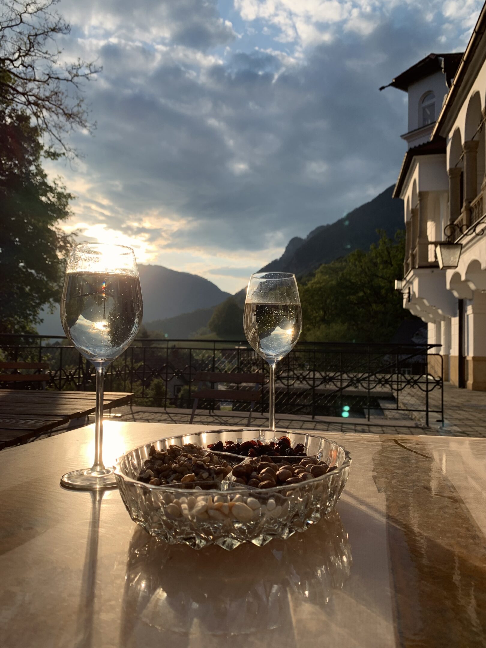
To wrap up, we enjoyed a coffee on the terrace at the Waldschlössl – in the sunshine, as clouds slowly gathered and the wind picked up. A fitting end to a thoroughly wonderful tour.
On this mild morning at the end of October, we woke up to snowfall and stormy winds – so we tried to delay our start. Just a few hours later, we were climbing uphill in bright sunshine – a completely surreal experience. The mountains are unpredictable, but that’s exactly what makes them magical.
By the time we reached the top, it was clear to both of us: we’ll only return here once the boys can hike on their own.
(Update May 2025 – Zita: Of course I’m still carrying L2 on my back.)
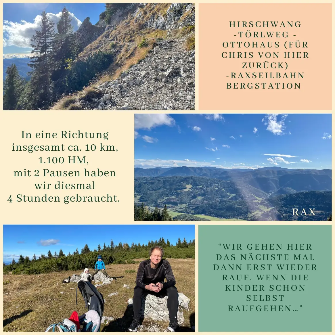
We met our friends at the Ottohaus – they had taken the cable car with their three kids, while we started from Hirschwang and followed the Törlweg. Not long after we arrived, Christian headed straight back: he ran down into the valley alone. I walked with the boys to the cable car station, and we descended together – and arrived at the base station at exactly the same time. We spent a total of four hours on the mountain.
📍 Distance: approx. 10 km
⛰ Elevation gain: approx. 1,150 m
⏱ Duration: 4 hours (gross)
Route: Hirschwang – Törlweg – Ottohaus – Praterstern – Rax cable car station
The most memorable hikes rarely go as planned – and that’s exactly what makes them unforgettable.
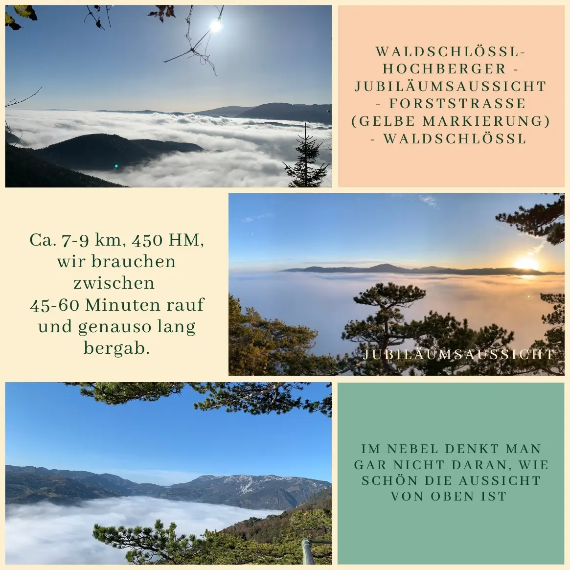
We’ve recommended the hike to Jubiläumsaussicht many times – this week I tested it twice to see if you can rise above the fog. Both times, I was lucky. 🌫🌅
Fog is a rare visitor here in Reichenau – maybe because of all the wind. But growing up in Veszprém (Hungary), I still wait for those foggy November mornings with a childlike excitement, when the Rax disappears from view or the valley wraps itself in a soft mist by late afternoon.
It was 2021. Chris’s dad was visiting us, which kept Leno fully occupied – so I took the chance to head out for a quiet morning run.
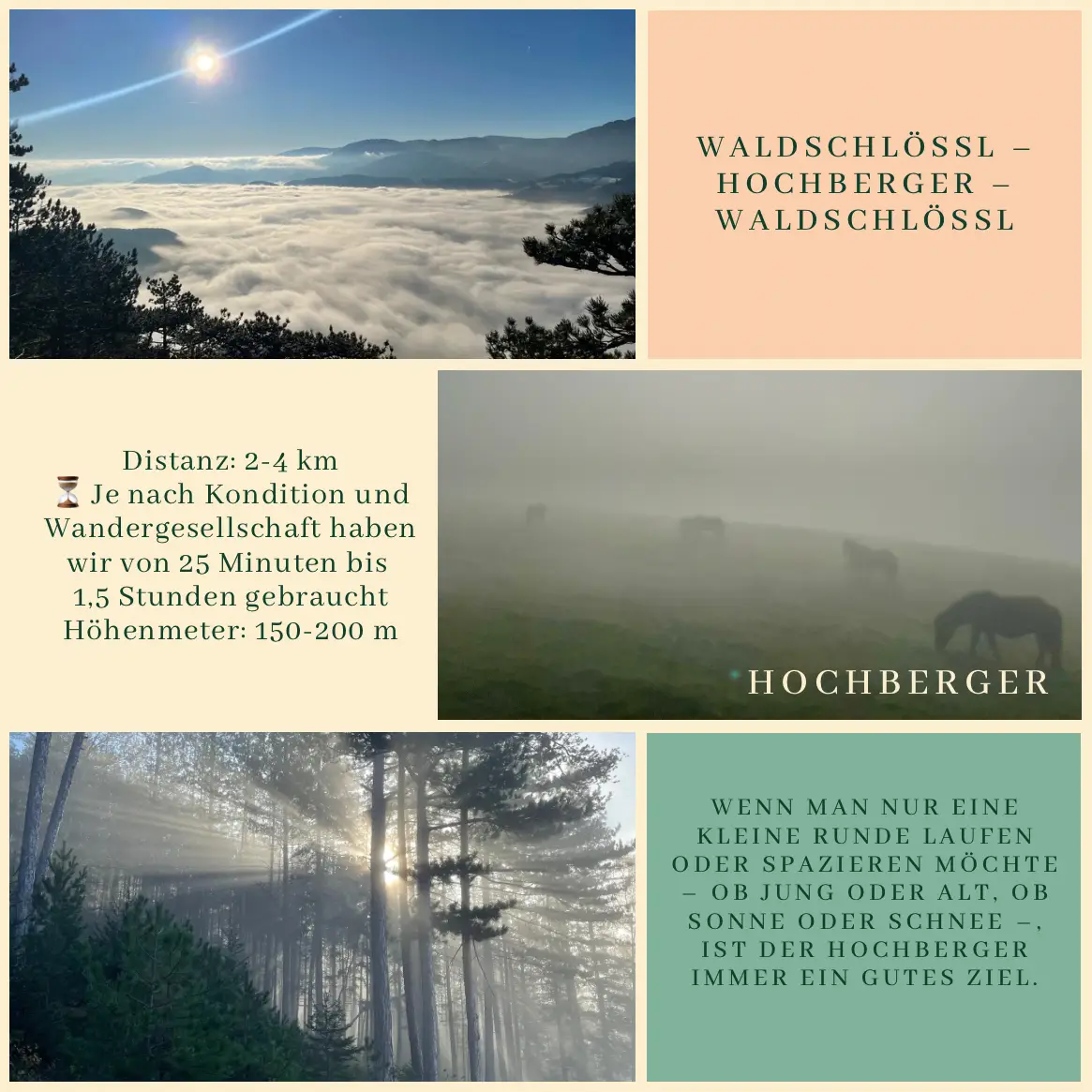
I started on the path next to the Waldschlössl, turned right by the new bee hotel under construction, and cut through a short forest section instead of following the paved road. At Hochberger, the surrounding mountains began to emerge, though the hills were still cloaked in thick mist. From there, it was about 25 minutes of brisk walking to the lookout, where the first rays of sunlight gently broke through the fog – a true gift of the weather.
On the way back, I followed the yellow trail: a bit further up the blue path, then left onto the tractor road, and after about half a kilometer, I was back on familiar trails heading home to the Waldschlössl.
If you ever want to experience the peaceful silence of the fog and the slow awakening of the hills, we wholeheartedly recommend this route – short, varied, and full of surprises in every season. 🏞🍂
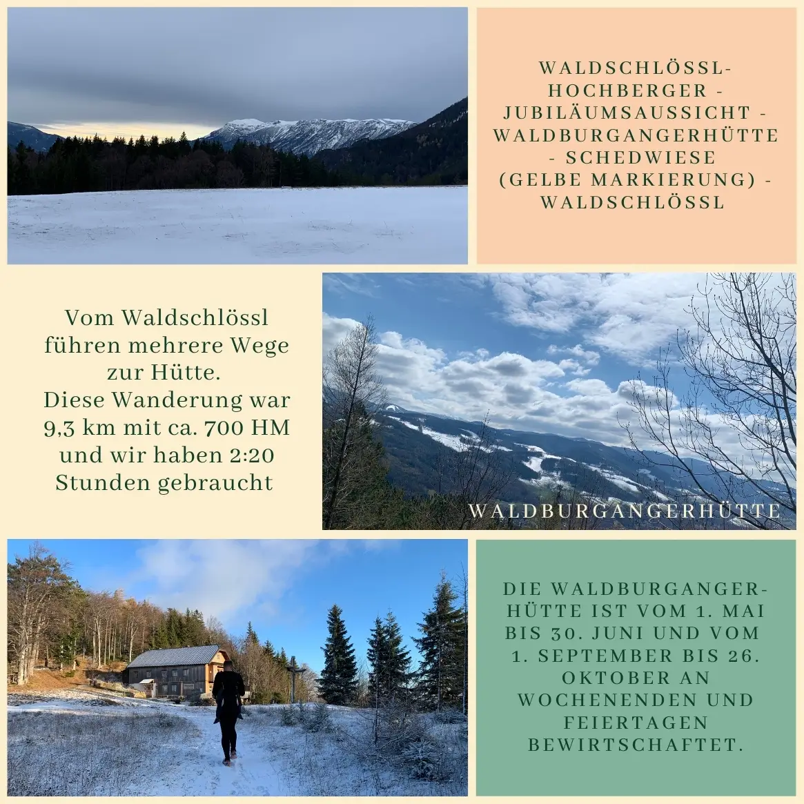
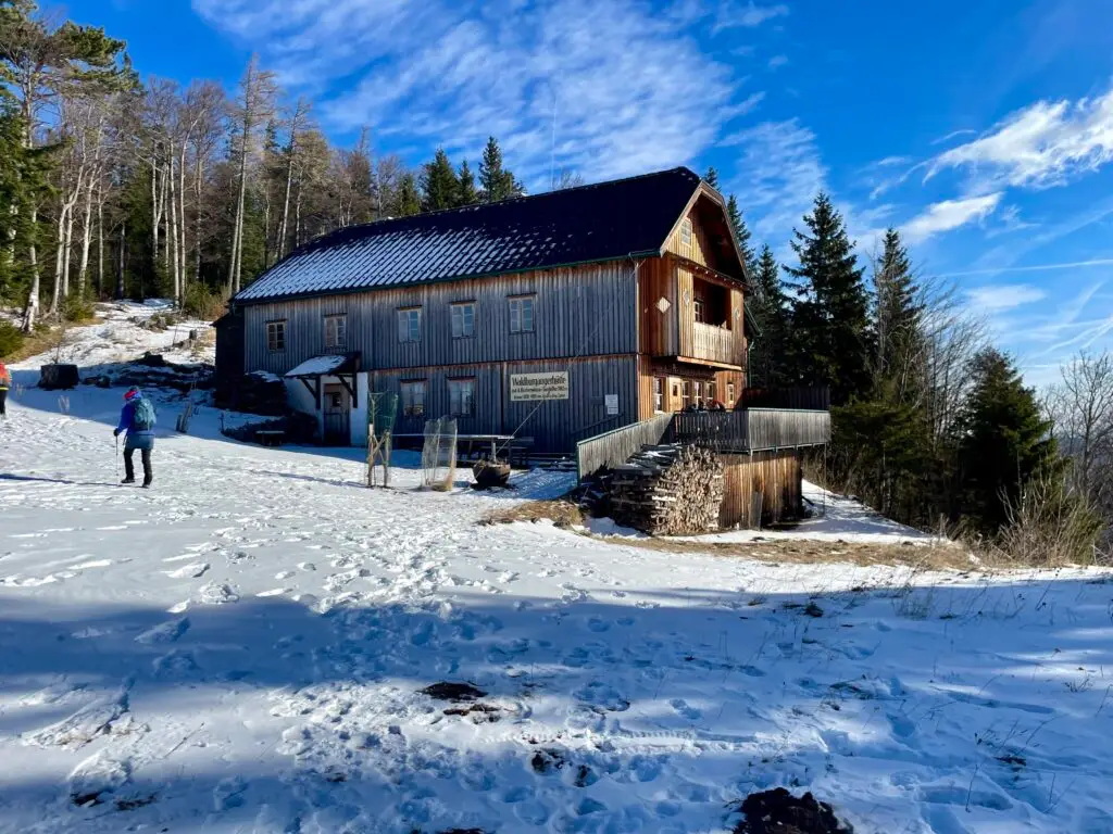
This time we did a brisk, scenic loop hike starting from Waldschlössl:
Jubiläumsaussicht – Waldburgangerhütte – Schedwiese, then back to the start.
The Waldburgangerhütte is open on weekends and public holidays from May 1 to June 30 and September 1 to October 26 – perfect for a well-earned rest and some refreshments at the top.
There are several ways to reach the hut from Waldschlössl – we followed the blue trail uphill. The Jubiläumsaussicht offers beautiful panoramic views. On the way back, we took the yellow-marked pathvia the Schedwiese, a wide meadow with scenic vistas. If the hiking trail feels too steep, you can switch to the forest road and take the serpentine route down.
📍 Distance: 9.3 km
⛰ Elevation gain: approx. 700 m
⏱ Duration: 2:20 hours
Route: Waldschlössl – Jubiläumsaussicht (blue trail) – Waldburgangerhütte – Schedwiese (yellow trail) – back to Waldschlössl
A great weekend outing – even with kids, if you adjust the pace to fit the youngest hikers.
How do you plan a hiking day with a baby carrier and as little gear as possible?
Simple: First, you write a list of the essentials. Then you head out – and leave the list at home. From that point on, all you really need is one thing: improvisation. (Sometimes in very literal ways – like sliding down snow. Without a sled. But we’ll get to that later.)
⸻
At 8:05 a.m., just 200 meters from the Waldschlössl, our neighbor Regina asked me:
– “Are you heading up to Marco today?”
And I honestly didn’t even know yet if we’d make it to the Naturfreundehaus Knofeleben.
The route? A Sunday classic: through the Eng, then instead of taking the Mitterberggraben turnoff, we went right toward the Lackabodengraben and continued on the trail toward Krummbachstein.
At the Krummbachsattel, the question arose:
➡️ Should we keep going toward the Schneeberg?
Or
☀️ Stay near Knofeleben, take it easy and enjoy a proper break?
Well:
👶 The baby was asleep.
🌞 The sun was shining.
🌡 The temperature was perfect.
🕙 And it was only 10:00 a.m.
So, we kept going.
⸻
At the ruins of Baumgartnerhaus (10:45), L2 woke up. We found a wind-sheltered spot with some shade and had a quick snack break (🤱🏼).
15 minutes later: another stop – L2 was still not fully on board (🤱🏼). Since I wasn’t sure if the last cogwheel train really left at 3:15 p.m., there wasn’t much room for hesitation. We had to move.
The next stretch was steep and rocky – L2 was not impressed. But after five minutes of mild protest, he fell back asleep. By exactly 12:00 noon, we made it to the top – and I was honestly just relieved we’d made it past that section.
What followed was just a pleasant walk to the Klosterwappen (1:05 p.m.). Truly pleasant. Until we hit a small patch of snow (or rather, ice) just below the Fischerhütte. L2 woke up again – and made it very clear he would prefer to keep sleeping. With curious hikers watching, a slippery path ahead, and the decision came quickly: Sit down in the snow, grab the rope – and slide. Well, I slid. On my butt. L2 screamed. Two minutes later: back asleep. Win.
⸻
All the planned stops (Damböckhaus, Fischerhütte, and Damböckhaus again) were skipped – L2 was sleeping too deeply. And just like that, we found ourselves at the final station of the Schneebergbahn at 2:05 p.m.
⸻
On the train, no one guessed that we hadn’t just hiked down from the Klosterwappen –but had walked the whole way from Reichenau, with baby carrier and all. By 3:00 p.m., we were already waiting in Puchberg for the replacement bus.
I’d love to say that the last walk from Payerbachback to the Waldschlössl was the perfect end to the day – but honestly, those last 90 vertical meters felt more like crawling and silent mantras than hiking, especially three months postpartum. L2? Blissfully napping again.
⸻
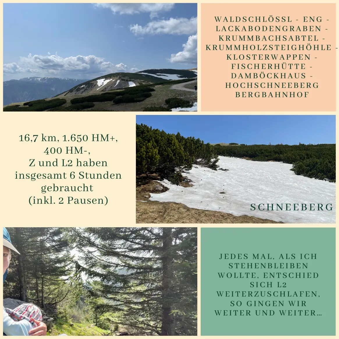
📍 Route:
Waldschlössl – Eng – Lackabodengraben – Krummbachsattel – Klosterwappen – Fischerhütte – Damböckhaus – Hochschneeberg mountain station
📏 16.7 km
📈 1,650 m ascent
📉 400 m descent
🕒 6 hours (including two short breaks)
👶 1 baby in the front carrier, backpack in the back
This weekend brought back that “classic” Schneedörfl weather: windstorm, drizzly (and sometimes snowy) rain, and a steady 3°C – just perfect for a little family outing!
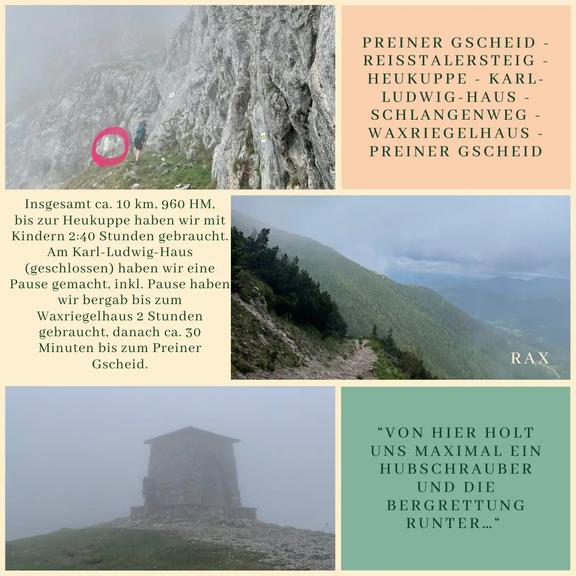
“At this point, only a helicopter or mountain rescue could get us down,” Chris muttered as we made our way up to the Heukuppe. The kids, snugly bundled in the hiking carrier and wrap, seemed to sense that this wasn’t the time for wild adventures. They just kept sleeping. And honestly, that was for the best.
We had planned a cozy family hike to the Heukuppe, the highest point of the Rax range. And well—cozy is a matter of perspective.
The Reisstalersteig quickly took us into alpine terrain. Chris murmured, “Hmm, I remember this differently…”—possibly because he’d filed away the short via ferrata under easy, back in his child-free, Carinthian hiking days. Technically, it’s not particularly difficult, but it does require sure-footedness, especially at the start, with a steep section and later, two ladders.
We were well-prepared for the weather—an oversized rain jacket for L2 and Z, a rain cover for the child carrier, warm layers—but the thickening fog and gusty wind still made things uncomfortable.
Leno, not yet three years old at the time (June 2023), climbed more than 300 vertical meters on his own—with great pride and determined little steps. It took us about 2 hours and 40 minutes to reach the Heukuppe with both kids.
We took a longer rest at the Karl-Ludwig-Haus—though not inside, since the hut was closed at the time. We sat in the winter room, ate our packed snacks, breastfed the littlest one, and recharged for the descent.
→ Update 2025: The Karl-Ludwig-Haus is now open again!
The way down via the Schlangenweg to the Waxriegelhaus was much more pleasant—solid footing, wind-sheltered, and the rain finally began to let up. That part took about 2 hours, then another 30 minutes back to the Preiner Gscheid.
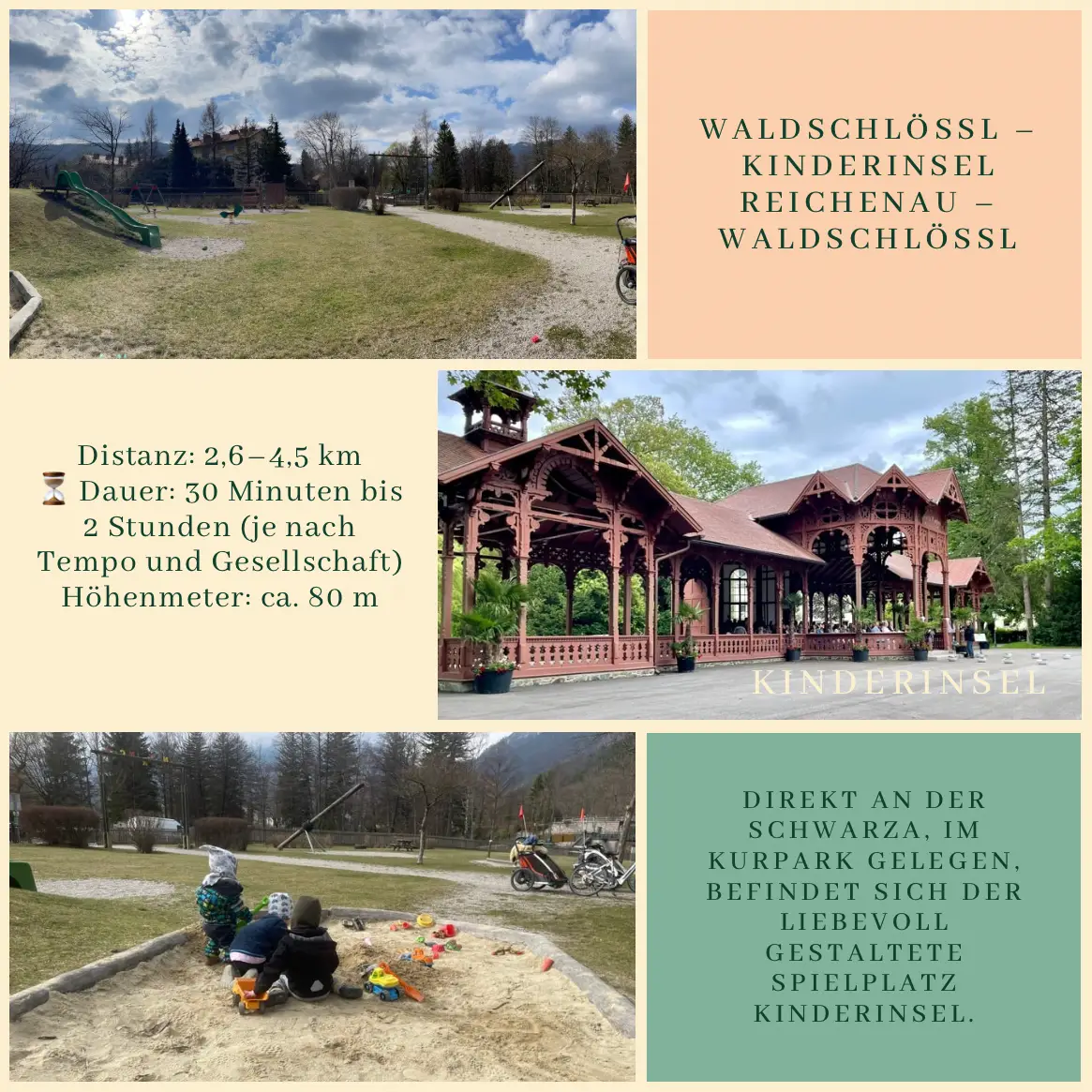
If you’re out and about with kids, a walk through Reichenau is definitely worth it. Right by the Schwarza river, in the spa park, lies the lovingly designed playground called “Kinderinsel.”
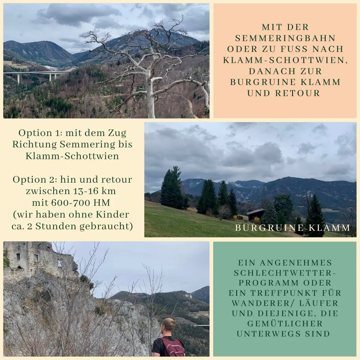
Some days go exactly as planned. Others… don’t. Today, we wanted to head to Prigglitz, but with some luggage to sort, a changeover in the guesthouse, and a well-deserved load of laundry, the day got away from us. So we started later than expected and changed our destination: Grillenberg it was – and we’re so glad we did!
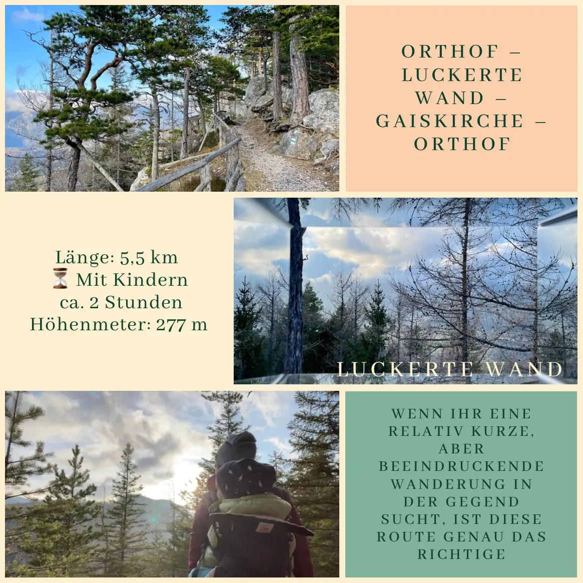
We made the most of the sunny weather and set off on a short but stunning hike with our visitors! Just a 15-20 minute drive brought us to Orthof, where we started our journey to the Luckerte Wand and continued to the Gaiskirche, a charming little chapel tucked away in the forest.
The trail is varied but easy to navigate, and the views make every step worthwhile! If you’re looking for a relatively short yet impressive hike in the area, this one’s a perfect choice. ⛰️🌲
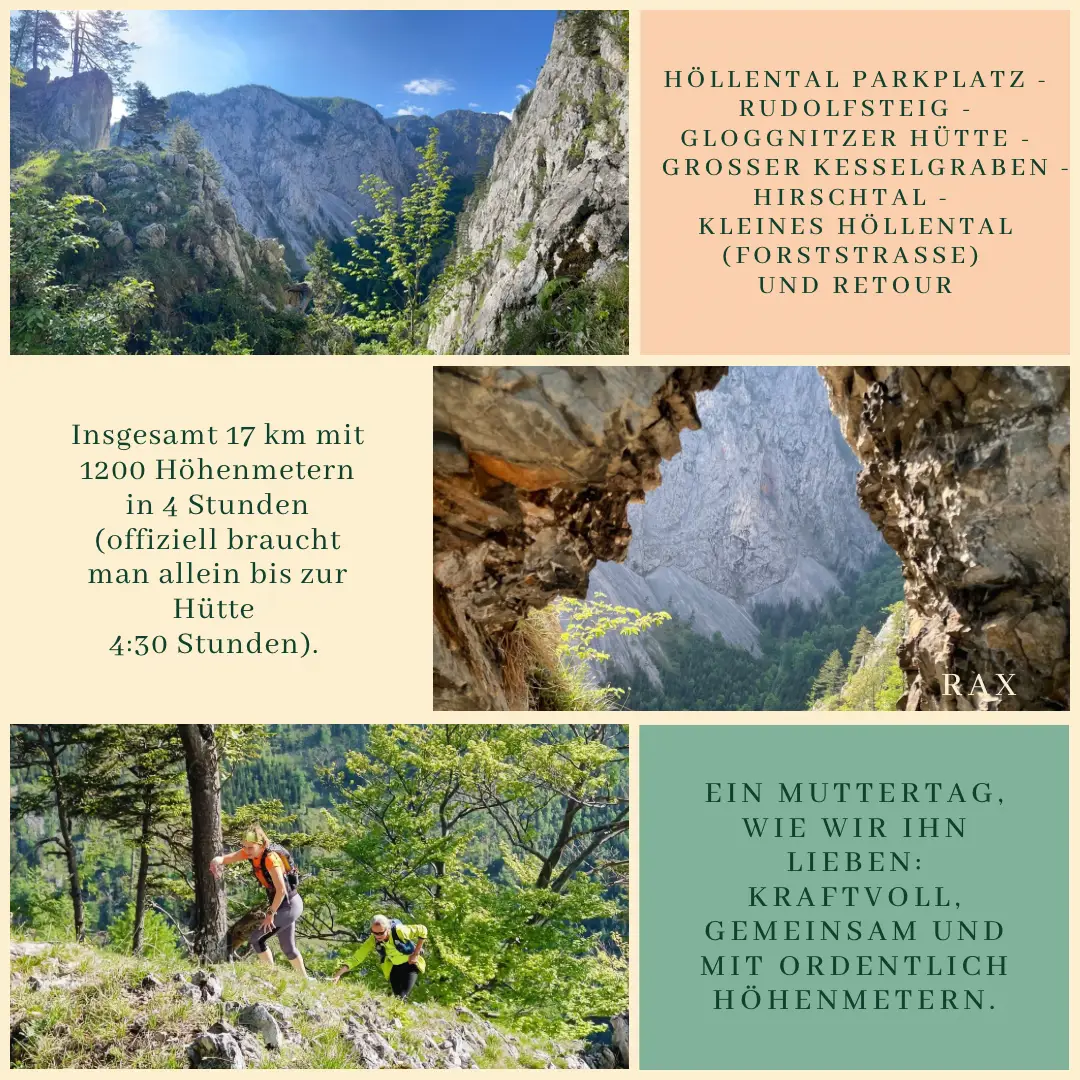
Forget brunch – this Mother’s Day, we decided to conquer the Rax. We kicked off our adventure at the parking lot by the main road, strapped on our backpacks, and hit the Rudolfsteig. Just 3 kilometers in, and we’d already climbed 850 meters. Anne’s smile might not have been entirely genuine on some of the more exposed sections, but who could blame her? The views made it all worth it.
The trail continued steeply through the forest, and after around 4 kilometers and 1100 meters of climbing, we reached the Gloggnitzer Hütte – the perfect spot for a quick breather and a warm elderflower drink.
For the descent, we opted for the faster route: a wide forest road through Hirschtal and on into the Kleine Höllental.
17 kilometers with 1200 meters of elevation gain in just 4 hours – the official time to the hut alone is 4.5 hours. Now that’s a Mother’s Day we can get behind – powerful, together, and packed with altitude.
Höllental Parkplatz – Rudolfsteig – Gloggnitzer Hütte – Großer Kesselgraben – Hirschtal – Kleines Höllental (forest road) and back
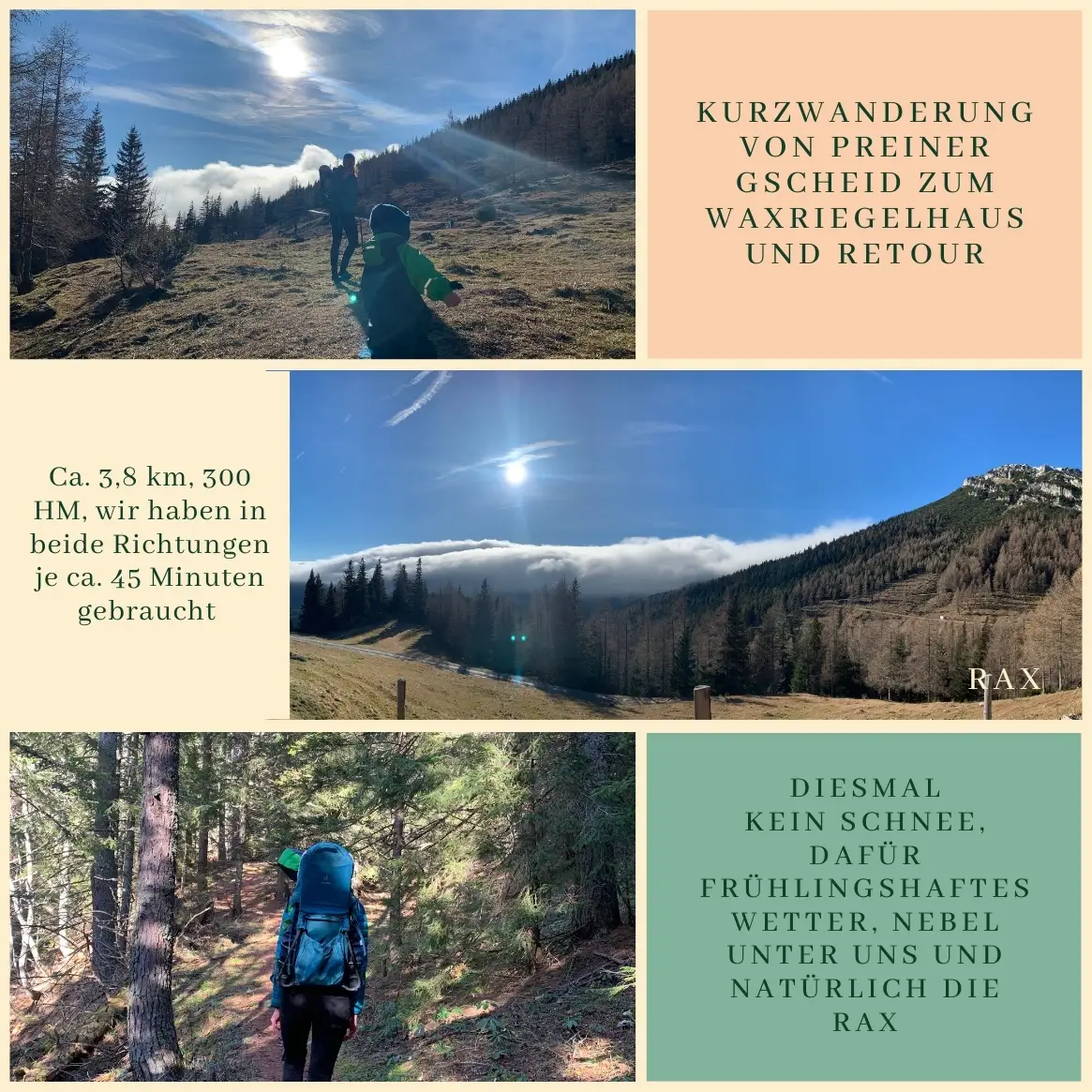
Last week, we took advantage of the beautiful spring weather and headed to the Waxriegelhaus. A special thanks to our wonderful neighbor, who not only kept us company but also made Leno’s midday nap possible – carrying a child on your back is no small feat! ❤️
We started at the Preiner Gscheid, sitting at 1,070 meters, just a 20-minute drive from our place, though it’s also accessible by bus from spring to autumn. From here, you have a few options for reaching the Waxriegelhaus: • The longer, more gradual tractor path: about 3.5 km one way, with 300 to 350 meters of elevation gain – perfect for a steady hike. • The steeper, shorter route: around 1.5 km one way, with the same elevation gain, for those who like a bit of a challenge.
Despite the usual snow at this altitude, we were lucky to enjoy bright sunshine, breathtaking views over a sea of fog, and a fantastic lentil stew at the Waxriegelhaus as a reward.
We took about 1.5 hours for the 3.8 km round trip, including a short nap break for Leno on the way up. On the way down, we had to pick up the pace to keep up with our little “express train,” who decided to tackle the whole descent on foot.
It’s an ideal short hike for families, and if there’s enough snow, it’s even perfect for a sled ride back down. On clear days, you can also continue up to the Rax peaks for even more spectacular views.
I always get a kick out of overhearing Hungarian hikers on the Rax. They tend to assume they’re the only ones around who understand their conversations: “Of course, my kids sleep in the car, but these Austrians seem to do things differently…”
But let’s start from the beginning. I’ve owed you this trip report for about two months now, but with another round of Rax-loving guests arriving tomorrow, I finally found the motivation to write it up.
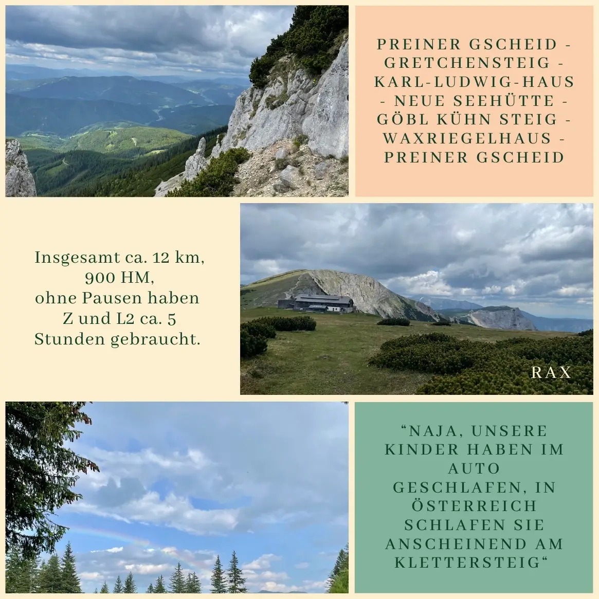
When Zsófi visited us in June, we knew we had to take her on a proper Rax adventure – you know, something for the memory bank. 😉
We set off on a sunny June morning (Zsófi and L) and a bit later in the day (Zita and L2), heading down to the train station in Payerbach. From there, we took a bus to the Preiner Gscheid, where our hike started about 30 minutes later. (And by the way, if you can decipher the bus timetable, you deserve a 10% discount on your next booking – here’s the challenge: Timetable.)
The lower sections of the Reisstalersteig and the Gretchensteig share the same path almost all the way to the Reisstalerhütte. Just before you reach the hut, a steep trail branches off to the right, offering fantastic views – at least until you’re swallowed up by the forest again. This is where Zsófi and L took a quick break, and I, driven by the motto “anything for a peaceful nap”, pushed on with L2. This stretch eventually leads up to the Gretchensteig itself. Just before the actual via ferrata, there’s a rocky section, which, if you ask me, is trickier than the secured climbing passage that follows – but I’ll let everyone judge that for themselves.
“Wait, is that a kid up there?!” “Hey, that’s a woman! Where’s her husband? Probably at home mowing the lawn.” “No way she’s making it up there. We barely managed to come down. There’s got to be another way.” “Of course, my kids sleep in the car, but these Austrians seem to do things differently…”
As the Hungarian group (decked out in full via ferrata gear) slowly picked their way down what they clearly considered “challenging” terrain, I had plenty of time to translate their colorful commentary for the Austrian hiker beside me – who, by the way, described the section as “no big deal”. Safe to say, we both got a good laugh out of it. 😉
And honestly, this whole encounter is a perfect example of how the same mountain trail can feel like a completely different challenge depending on who you are and how you approach it.
Once we reached the top, we skipped the usual break at the Karl-Ludwig-Haus and continued straight to the Neue Seehütte. About 30 minutes before reaching the hut, we had to pause for a quick hillside picnic (L2’s idea), before tackling a steeper descent that ended with a fantastic, gluten-free, vegan lentil stew.
The mountain had one last surprise for us – a sudden hailstorm (oh, June, you never fail to keep us on our toes) – before we met back up with Zsófi and L at the Waxriegelhaus. Together, we made it just in time for the last bus down.
Final stats: Roughly 12 km, around 900 meters of elevation gain and loss, and about 5 hours of hiking time with L2, plus three snack breaks. And as a little parting gift, we even caught a rainbow on our way back – a nice way to make up for the earlier hailstorm. 🌈
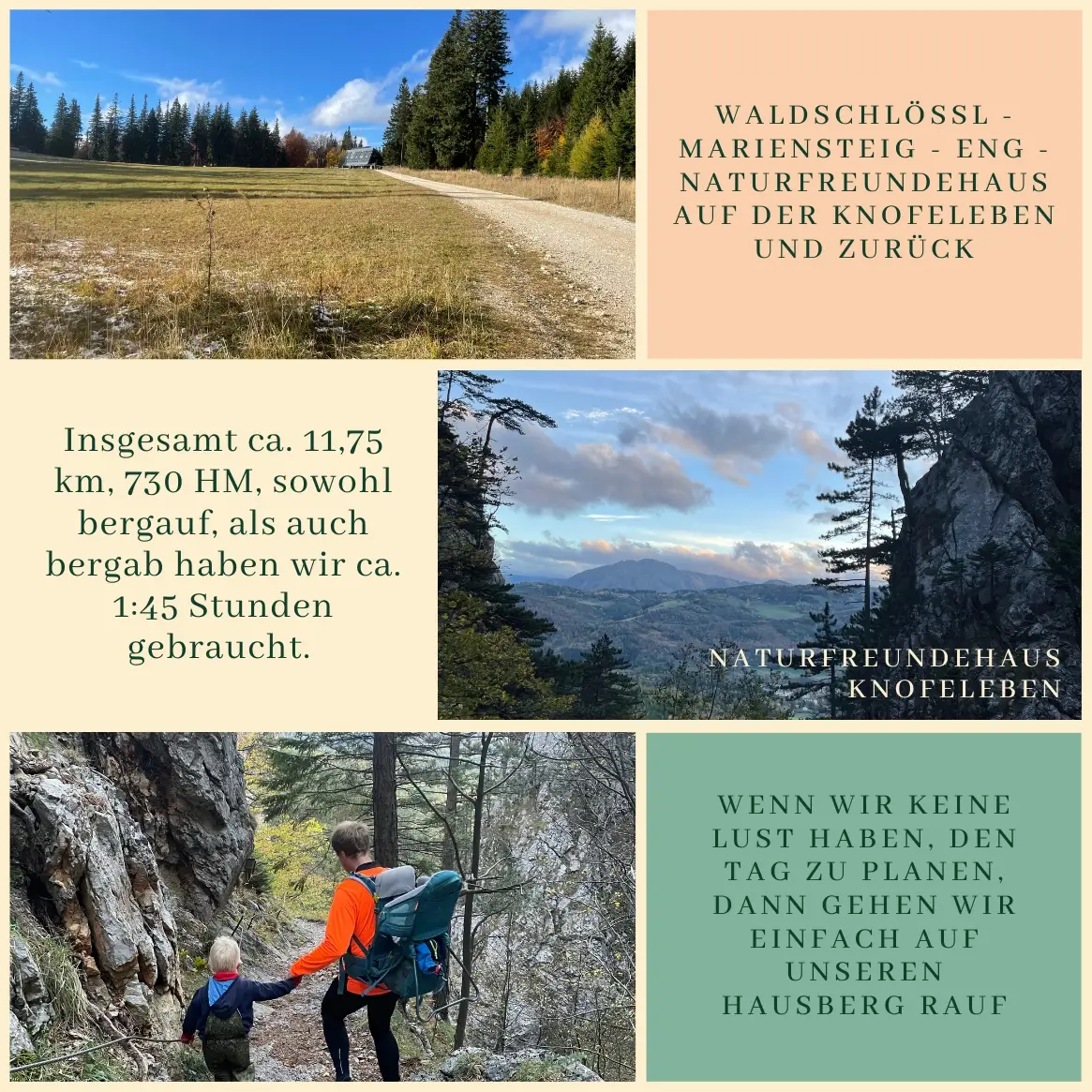
At the second junction, we take the middle road toward Talhof, then the second forest path on the right – the one that leads up to the Naturfreundehaus Knofeleben. No need for heavy packs today, since we know we’ll be up there in less than two hours, and we can skip cooking for the day. Marco’s Naturfreundehaus is one of those rare places where both of us have plenty of options: almost everything on the menu is gluten-free, and the vegan selection keeps growing. Today’s menu:
Pumpkin soup for L2, Ch, and Z Potato goulash with beans for L1, L2, and Z Blueberry strudel for Christian and L1 And, of course, a special oat milk latte for Z, as Marco likes to say, “Just for Mrs. Waldschlössl.” 😉
Both the hike up and down took about 1 hour 45 minutes each. Impressively, L1 managed the entire descent on his own, except for a 500-meter stretch. (On the way up, though, he mostly hitched a ride or took his time, so the boys – Ch and L1 – arrived about 20 minutes after us, but at least we had a table waiting by then.)
Route: Waldschlössl – Mariensteig – Eng – Naturfreundehaus Knofeleben – and back
Total: about 11.75 km, 730 meters of elevation gain.
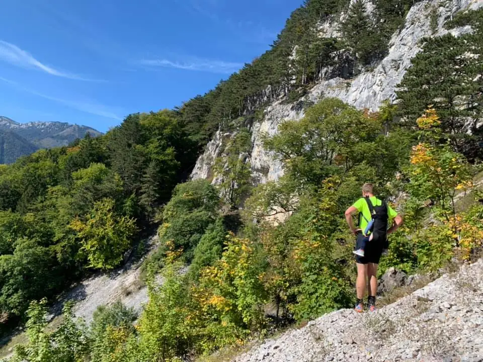
At some point below Mittagstein, I stopped taking photos. Right around then, I also made two important decisions: I need proper hiking boots, and I need trekking poles. Chris, just six weeks post-surgery for his double ligament tear, found the trail pleasant. I found it – how should I put it – rather adventurous.
As we prepare to open our café, we’ve been gathering all sorts of experiences – the good, the bad, and the delicious. Here, we’ve put together a list of our favorite gluten-free options in the area, but as always, be sure to double-check when you visit. This is just a quick overview to help you navigate the local restaurants, mountain huts, and shops.
Schloss Stuben
A traditional Austrian inn with a cozy, rustic vibe. So far, the trout with lecsó has been a reliable gluten-free choice. Haven’t tested the rest of the menu yet, but there are always salads and other safe options. 🌐 schloss-stube.gusti.at
Payerbacherhof
Another classic Austrian spot with a warm, welcoming atmosphere. The staff are very attentive, but be sure to mention celiac disease clearly – and maybe even double-check. 🌐 payerbacherhof.at
Reichenauerhof
One of our all-time favorites – we’ve never had any trouble finding gluten-free options here. Sadly, it’s temporarily closed at the moment. 🌐 reichenauerhof.com
Cake Shop:
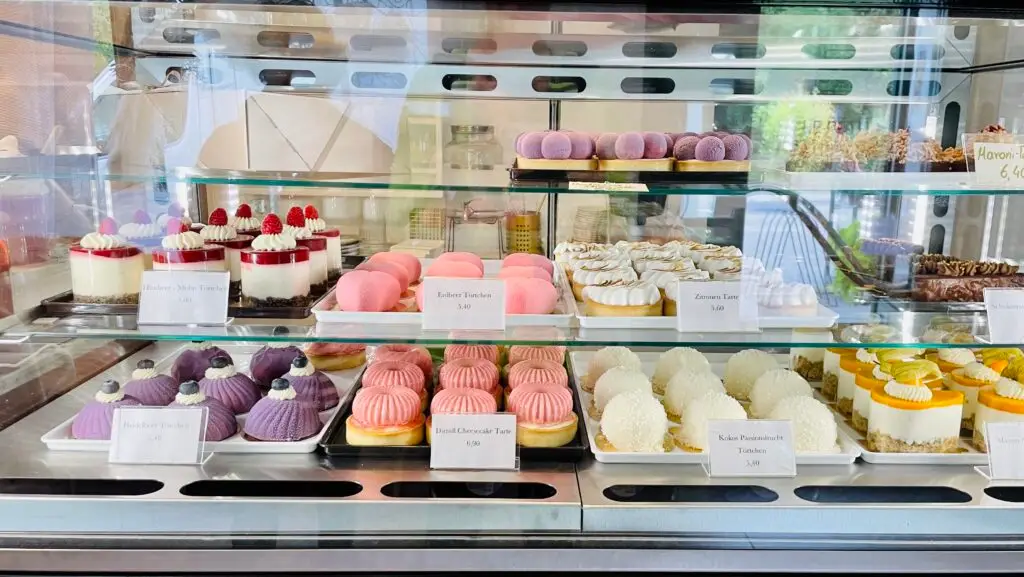
Le petit Pâtisserie
A charming little patisserie in Reichenau, known for its stunning cakes. The owner, Sophie Hirschegger, puts incredible effort into her creations. They’re as delicious as they are beautiful. Note: the opening hours are a bit limited.
Both stores have a solid selection of gluten-free products. Each has a dedicated gluten-free section, and Billa even offers gluten-free Kaiser rolls in the frozen aisle.
Naturfreundehaus Knofeleben
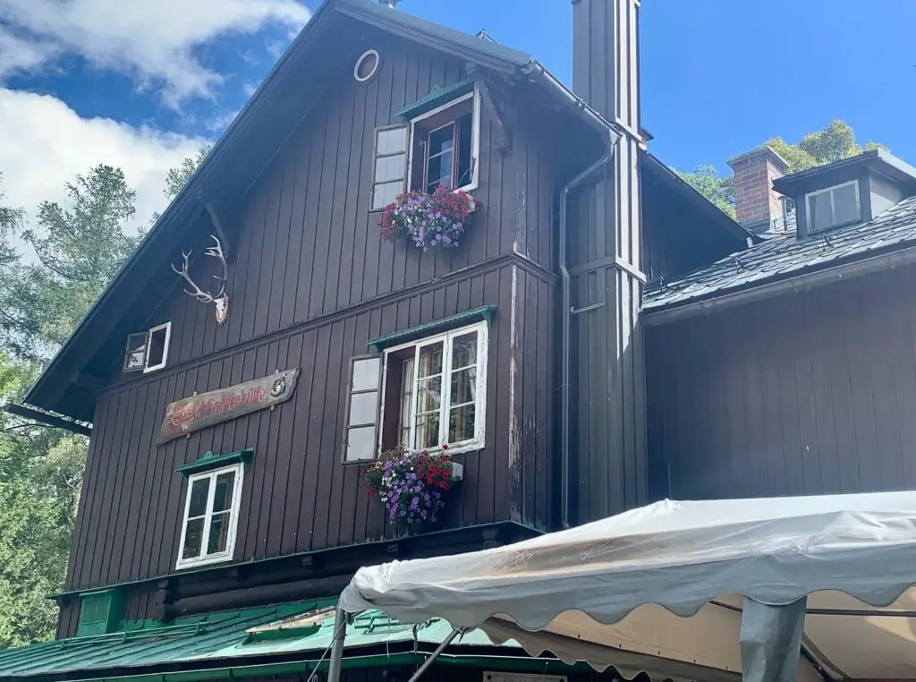
About 6.5 km and 700 meters of elevation from us, this is one of our favorite hiking destinations. It’s not accessible by car, but it’s worth the trek. Nearly everything here is gluten-free unless obviously not (e.g., bread, certain soups). Just ask Marco, the hut manager, for guidance. 🌐 knofeleben.at
Speckbacher Hütte
Another great hiking destination, though this one is also reachable by car. Alexandra, the hut keeper, is very knowledgeable about gluten-free options and always happy to help. Highly recommended. 🌐 die-speckbacher.at
Looshaus am Kreuzberg
A popular spot with fantastic views and excellent food. We’ve had great experiences here every time – never a problem with gluten-free options. 🌐 looshaus.at
Waldburgangerhütte
About 4 km (and 650 meters of elevation) from Waldschlössl, this hut is run by Maria, who bakes and cooks everything herself. The lentil soup and cranberry cake are both gluten-free. The hut is open on weekends and public holidays from May 1 to June 30, and from September 1 to October 26.
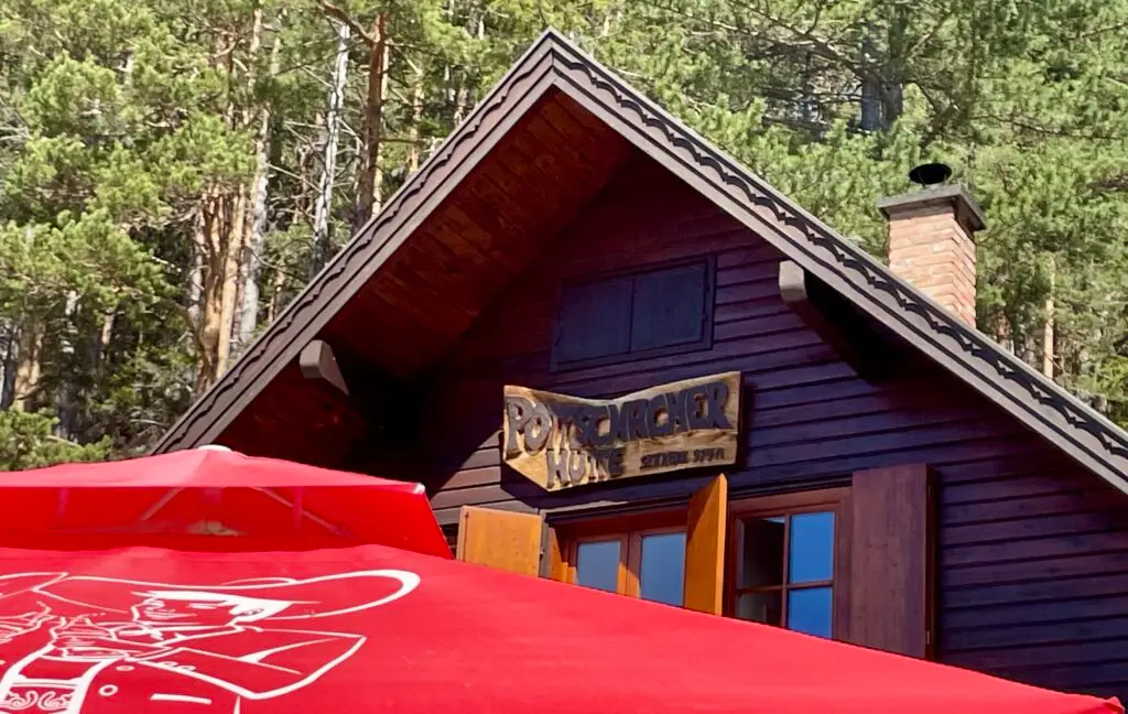
Pottschacherhütte
A good choice if you’re planning a longer hike or a relaxed bike ride, or if you prefer a shorter walk from the parking area. Just ask Bianca, the hut keeper, about gluten-free options. 🌐 pottschacherhuette.naturfreunde.at
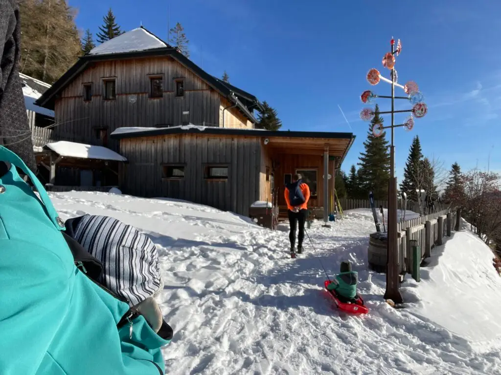
Waxriegelhaus (Rax)
One of our top winter spots. Just a 20-minute drive from Waldschlössl to Preiner Gscheid, then a 3.5 km hike up (or 1.8 km if you take the shortcut over the meadows – about 300-350 meters of elevation gain). They usually have soup, lentil stew, and occasionally sausages and gluten-free bread.
In winter, the way back down is a fun 1.8 km sledding run. In spring and summer, it’s a great family destination or a nice spot to wait for the bus after a longer Rax tour. 🌐 waxriegelhaus.naturfreunde.at
Neue Seehütte (Rax)
I’ve generally had good experiences with smaller huts where you can talk directly to the owner, and this one is no exception. The lentil soup was a safe choice here, as it often is. 🌐 neue-seehuette.at
Damböckhaus (Schneeberg)
Another absolute recommendation. About 15-20 minutes from the cog railway’s top station on Schneeberg, or about an hour if you take the route via Waxriegel. For those feeling ambitious, you can hike up all the way from us – but that’s quite a trek, so let’s chat about it first. They usually have gluten-free rolls, lentil soup, and more. 🌐 damboeckhaus.at
A bit of a local secret for those skiing at Stuhleck. You’ll need to ask about gluten-free options, but they usually have one or two good choices. 🌐 friedrichhuette.at
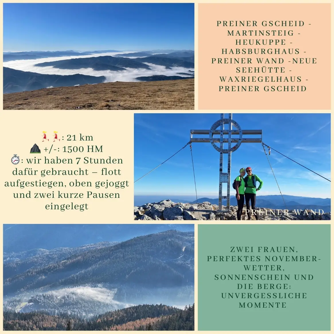
On a beautiful November day, we embarked on the Preiner Gscheid – Martinsteig – Heukuppe – Habsburghaus – Preiner Wand – Neue Seehütte – Waxriegelhaus – Preiner Gscheid trail, which is almost 21 km long and includes 1500 meters of elevation gain (+ and -). We spent 7 hours on the trail, taking our time with the ascent, jogging a bit at the top, and enjoying two short breaks. It was just Gina and me, no kids this time.
We drove to Preiner Gscheid by car, where we set off on a new and exciting route for us. The Martinsteig reminded me a bit of the Gretchensteig. After reaching Heukuppe, we continued to the Habsburghaus. By the time we got there, it was, of course, closed, but we still took a break on the terrace. The November sunshine made the moment extra special. The weather was simply perfect.
This hike was a true gem, with stunning views and a peaceful atmosphere, making it well worth the effort.